


Experience paradise.


Charming villages.
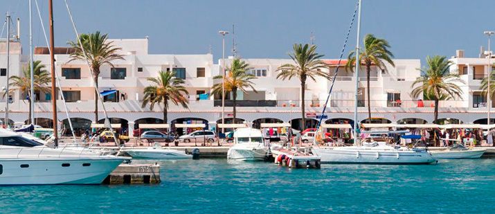
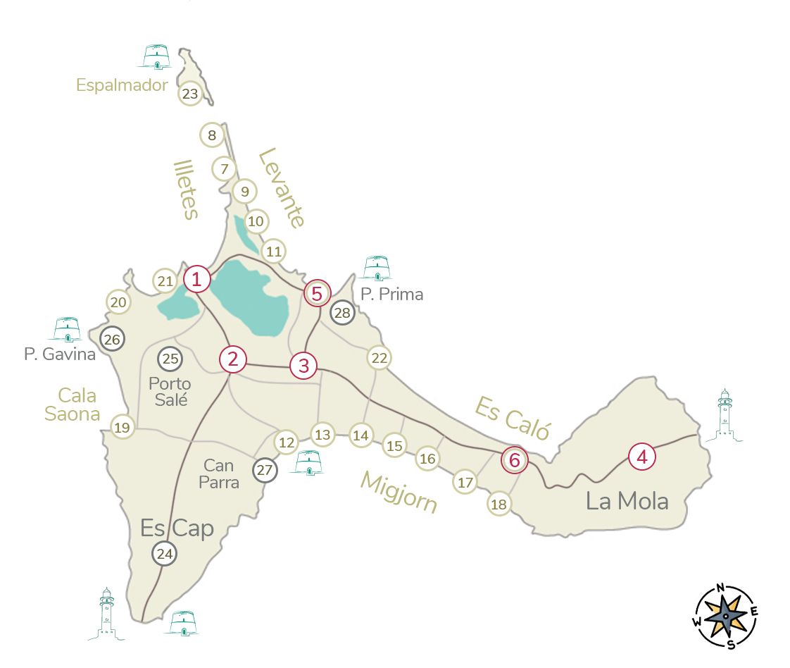
1. La Savina (Port)
The only gateway to Formentera, this welcoming port seduces us with its lively atmosphere.
Ferries arriving with tourists, boat trips, diving, snorkeling, rental boats, cyclists in search of the dreamy beaches of Illetes… they all pass through here.
The artisan market invites you to browse its stalls, and the gastronomic offering is excellent.
Our favorites restaurants: Café del Lago, Can Carlitos and Quimera, also ideal for sunset. If you’re looking for atmosphere, Cala Duo is the place to be. And a coffee at the Amarre 32 bar, to revel in the lively bustle of the port.

2. Sant Francesc
Formentera’s main town, Sant Francesc is the heart of the island.
A stroll through its lively streets should include the church, the old cemetery, the Sa Tanca Vella chapel, the Ethnographic Museum, the Mercat Payés, featuring local Formentera products, and the exhibition centers.
The best time to explore is in the morning, when the terraces invite you to enjoy a coffee in the sun. Or in the evening, when the restaurants light up, creating charming corners.
Our favorites: Es Marés, Ca na Pepa, Gioviale (amazing pasta), Fonda Platé, Mama Carmen y Can Carlos.

3. Sant Ferrán
When the sun sets and the lights come on, Sant Ferrán comes alive.
The streets become a promenade that converges on the lively square, where there’s often music, al fresco cinema, and lots of young people gathering.
The artisan market’s stalls fill the town with their art, and some of the island’s most iconic restaurants are located here.
Our favorites: Macondo, Can Forn, La Trastienda, Casa Natalia and Sa Panxa. Don’t miss: a drink at Fonda Pep, breakfast at Blat Picat.

4. La Mola
At the highest point on the map of Formentera, this inland village emerges, captivating us with its serenity and wonderful views.
On Wednesday and Sunday afternoons, the island’s most important Craft Market is held here, giving this town a unique artistic spirit. Designer shops, bars, and small restaurants flourish next to the market, making these afternoons a true delight.
From the village, the road runs straight through a dreamy rural landscape of sheep, fig trees, vineyards, and more, until it reaches the cliffs above which the imposing La Mola Lighthouse rises.
Beachside villages.

5. Es Pujols
In a calm bay that opens to the east, Es Pujols enchants us with the beauty of its beaches and its charming seaside promenade.
It is the most touristy town on the island, with a good selection of hotels and apartments.
After sunset, the seafront promenade comes alive, artisans open their stalls, restaurant terraces fill with tourists, and cocktail bars liven up the atmosphere well into the night.
Our favorite restaurants: Bocasalina, Chezz Gerdi, Tahiti Beach, Integral (vegetable). And sunset on the terrace of 5 Flowers (Sky Cocktail Club).

6. Es Caló
The sea is such an intense turquoise that it hardly seems real. Es Caló is the perfect Mediterranean postcard, with its whitewashed houses and pristine beaches, dotted with picturesque fishing sheds “varaderos”.
Sheltered from the winds, this small spot once served as the island’s natural harbor. Today, it’s the place of choice for lovers of the slow life.
Spend the day lying on the beach, exploring small coves with a pair of snorkeling goggles (a must), and delighting in the fantastic gastronomic offerings.
Our favorite restaurants: Rafalet, Es Caló and Can Pascual.
Here you have it all… Es Caló will captivate you with its magic.
Best beaches and bays.
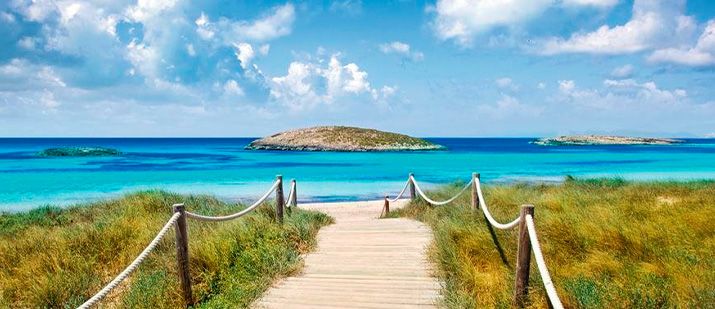
7. Ses Illetes
One of Formentera’s most iconic spots, Ses Illetes is the perfect beach: white sand, shallow water, and a brilliant turquoise color. The islets that give it its name protect it from the open sea.
Part of the Ses Salines Natural Park, its dunes are protected by access walkways and there are parking areas (limited spaces). Vehicles pay admission, except for electric vehicles and bicycles.
Take one of the best swims of your life, lie in the sun, savor a delicious dish in one of its exclusive restaurants (Molí de Sal, Juan y Andrea, Tiburón, Pirata and Beso Beach), and let yourself be carried away by the music and the lively atmosphere at sunset.

8. Punta de Es Trucadors
The idyllic beaches of Es Trucadors are a treasure for hikers. The bravest will have to walk more than 1.5 km to reach the end of this point and contemplate the wild beauty of Espalmador Island, to the north of Formentera.
If you’re looking for wonderful beaches and tranquility, this is a great place. The further you venture into this fine strip of sand, the easier it will be to find your own private and unique spot.
Please note that there are no services in this area, so you’ll need to bring water and a lunch box if you plan to spend the whole day here. Please don’t make piles of stones; we don’t want to disturb the habitat of the creatures that live here.
9. Levante / Tanga
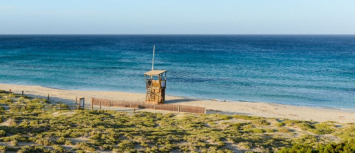
The Levante beaches are, in our opinion, one of the island’s gems.
The northern section (within the Ses Salines Natural Park) is particularly impressive, with very wide beaches, as perfect as those of the iconic Ses Illetes, but considerably less crowded.
To get there, use the same access road to Ses Illetes. From any of the parking areas, you’ll find wooden walkways leading east. A short walk will take you to the beach.
Vehicles pay to enter, except for electric vehicles and bicycles.
There is only one restaurant, Tanga, an island classic.
10. Levante / Manolito
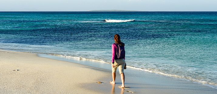
We’ll let you in on a secret… not many travelers know about this entrance to Levante, so you have a good chance of finding a wonderful beach area, one of the best on the island, not as crowded.
This is the location. You access it via an unpaved road that starts next to the Laguna store and leads to the parking area.
Since it’s located within the Ses Salines Natural Park, entry is free for vehicles, except for electric vehicles and bicycles.
Enjoy a wonderful swim and sunbathe, take a walk exploring the endless beaches, and end the afternoon with an aperitif at the relaxed chiringuito Manolito beach bar.
11. Levante / Sa Roqueta
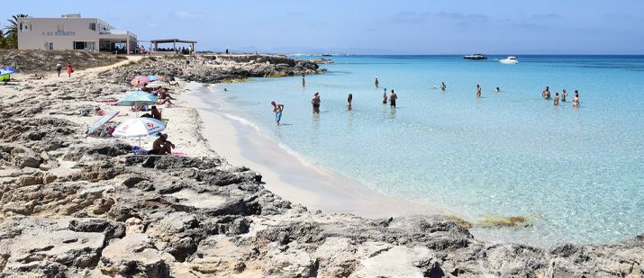
Between the Sa Roqueta Hotel and the Roca Bella Hotel, there’s a succession of small beaches bordered by rocky promontories.
This is the southern part of Levante, the perfect place to find your own little spot of sand and forget about the world.
There are several access points, some lesser-known than others. We recommend Sa Roqueta and Ses Canyes (take the path that leads out in front of Caminito Restaurant, then the fork to the left). And this is the location in the Formentera map of our favorite and least-known access points; it doesn’t have a name… Keep it a secret
12. Migjorn / Es Mal Pas and Can Martí
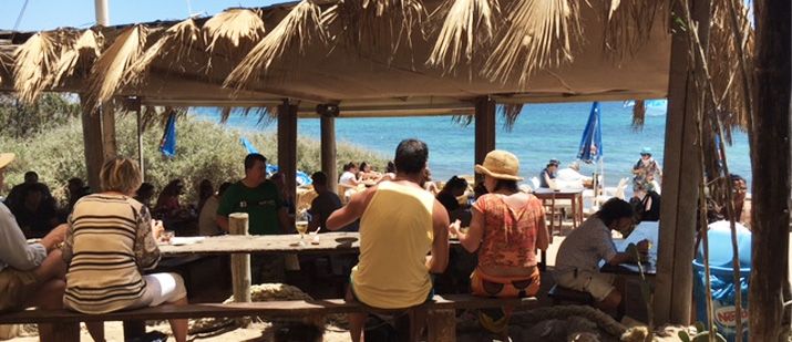
The southernmost part of the Migjorn coast is a peaceful spot, ideal for a family vacation. Its idyllic atmosphere recalls the Formentera of its early tourists.
The beaches intertwine stretches of sand with areas planted with posidonia, creating one of the island’s most pristine landscapes.
There are some excellent restaurants: Casbah and Paraíso de los Pinos (modern Mediterranean); Ses Eufabietes (family-friendly); and the Pelayo beach bar.
The neighboring area of Can Marti is home to the old des Pí des Catalá watchtower, the only one that can be visited inside. Nearby is one of the island’s must-do: Sa Platgeta restaurant.
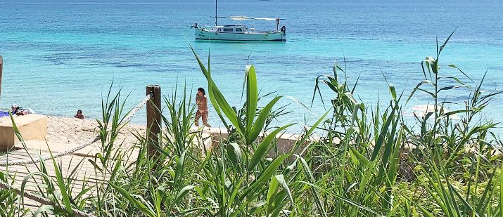
13. Migjorn / Ca Mari. Formentera Map.
The central area of Migjorn is home to a small urban complex of apartments and restaurants known as Ca Mari.
The coastline is a succession of sandy beaches bordered by small rocky promontories; the atmosphere is relaxed.
There’s a varied culinary offering, from the Kiosko Ca Mari, perfect for a simple meal by the beach, to the super-chic restaurant Gecko.
The day inevitably ends at the chiringuito Karai beach bar, enjoying the lively atmosphere at sunset.

14-15. Migjorn / Km 8-10
On the island, you’ll likely hear Migjorn “km number” indication. This sign refers to the location on the main road with a specific access to the beach, which usually ends at a restaurant or beach bar.
Migjorn, between km 8 and 10, is incredibly perfect. White sand, turquoise sea, savin forests, and very few buildings.
You reach the beach via the accesses to the restaurants Es Codol (highly recommended); Vogamarí (famous for its rice dishes); and the legendary Blue Bar (food, music at sunset, drinks, and a disco until dawn). The Blue Bar entrance connects you to the new chiringuito Amar beach bar.

16. Migjorn / Km 10.5
We’ll take a moment to highlight this access to Migjorn Beach on the Formentera map, which we particularly like, at km 10.5.
Just drive to the beach; there are no beach bars or restaurants here, just beach, and more beach. It’s not a well-known access, so you’re sure to find your own quiet and private spot.
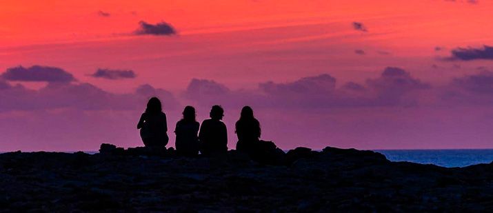
If you’ve been thinking of surprising your partner with an intimate sunset on the beach, this might be the place.
Very close by, our favorite spot on the island to enjoy the sunset: the rooftop bar at the Teranka Hotel. Don’t miss it!
17. Migjorn / Arenals
The Arenals beaches are some of the best in Migjorn, wide and expansive, with crystal-white sand and an absolutely clear sea.
A few bungalow complexes, camouflaged in the forest, offer accommodation in a very relaxed atmosphere.
Spend the day alternating wonderful swims with relaxing moments in the sun, with a break to enjoy pleasant restaurants, from the family-friendly La Fragata (Mediterranean cuisine) to the boho-chic options at 10.7, Las Dunas and Hannah.
Sunsets at the beach bars at Km 11 and La Gitana are an island classic, with music and a great atmosphere.
For a more chilled-out experience, head to the terrace at Bichi insula Beach or the Las Dunas restaurant.
18. Caló des Mort
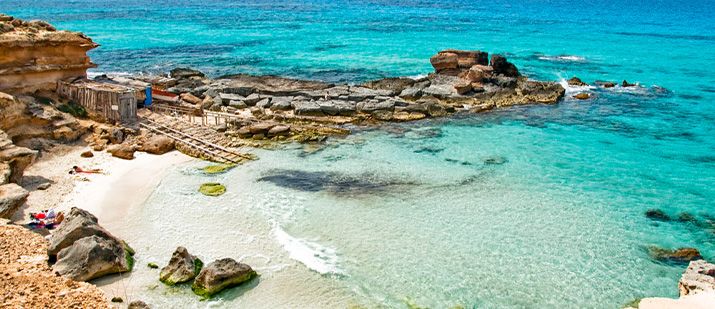
A tiny, idyllic beach with its fishermen’s huts, tucked between the cliffs of La Mola and the end of Migjorn Beach, sparkling like a diamond in the sunlight.
To get there, take the entrance to the Maryland-Riu, and from there walk along the coast to Caló des Morts. It’s best to arrive early, as it tends to be very busy. And don’t forget your snorkeling goggles! If you like swimming, continue to the nearby Cala des Ram, a rocky beach ideal for snorkeling.
The sunset is spectacular, whether from the beach or the cliffs, or if you prefer, from the relaxed chiringuito de Bartolo beach bar.

19. Cala Saona – Map of Formentera
Nestled on a cliff-lined coastline, this small beach is one of the island’s most delightful spots. Sheltered from the winds, it was used to build boathouses to shelter traditional llauts, giving it a special charm.
It opens to the west, so from here you’ll see one of the best sunsets of your life, from the beach or from Punta Rasa.
The Bocaboca beach bar has a great atmosphere. For a more chilled-out experience, the terrace of the Hotel Cala Saona hosts a sunset party with DJ music and cocktails. The food is excellent, both at the hotel and at the restaurant Sol.
20. Can Marroig / Piscinas naturales
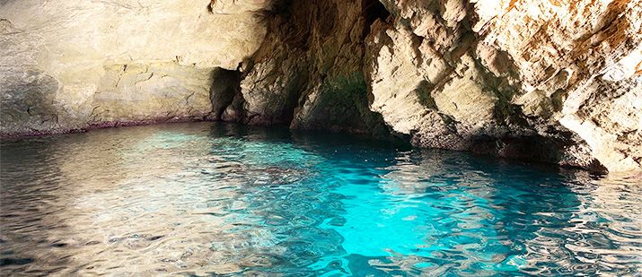
Between Punta Pedrera and the spectacular Torre de La Gavina, a rugged, wild, and isolated coastline stretches out, a desert of unusually shaped rocks (once a quarry). It hides caves and fairly deep coves, known as Natural Pools.
The water is crystal-clear and teems with marine life. To fully enjoy it, we recommend coming by sea, with a kayak, paddleboard, or renting a small boat.
You can also reach it from land, but the trail is somewhat difficult. It starts at the parking lot of the Can Marroig, interpretation center. It’s essential to bring good footwear and snorkeling equipment. Also, bring water and a snack (there are no services).
21. Caló de S’Olí
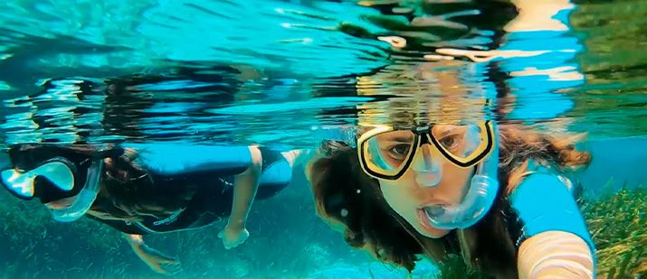
One of the places we recommend if you want to get off the typical tourist map of Formentera. This semicircular bay stretches between Punta Pedrera and the mouth of S’Estany d’Es Peix. Dunes, wild vegetation, and rocks intermingle right up to the water’s edge, creating a wild-looking environment.
The water is crystal-clear, and the views of Ibiza are breathtaking. You’ll always find a sandy spot to lie down, or even better, a mattress of dried posidonia.
Remember to bring your snorkeling mask, as it’s the perfect place to explore the posidonia meadows. This is the location of the parking lot and the access walkway.

22. Cala En Baster
Probably the most spectacular cove in Formentera, so beautiful it looks like a painting. Its imposing height, the clarity of its waters, and the random shapes the wind shapes in the sandstone rocks are striking.
Sheltered from the wind, it shelters picturesque traditional, cave-like boathouses “varaderos”.
There isn’t much space to lie down, so we recommend visiting with an active plan. Bringing a snorkel is essential to enjoy this wonderful corner of the island. The cove opens to the east, so the light is best in the morning.
23. Espalmador
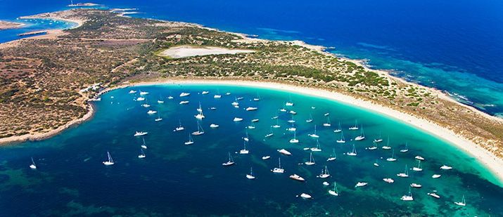
This small island is very close to what paradise should be.
It’s a tiny territory in the north of Formentera, dominated by nature, where the beaches are of fine white sand, the water is turquoise, and the vegetation is wild. It enjoys the maximum protection of the Ses Salines Natural Park, so no construction is allowed, there are no beach bars.
At the highest point stands the Sa Guardiola Tower, built to keep out pirates.
It can only be reached by sea. The best option is to take a boat trip or rent a small boat to enjoy Espalmador at your leisure.
Places you can’t miss.
24. Es Cap de Barbaria
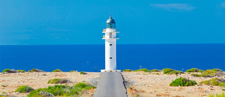
A desert landscape. A narrow road. The distant lighthouse and the deep blue sea behind it… An iconic photograph from the film “Lucia y el sexo” that inspires thousands of travelers.
From the Es Cap intersection, the road passes through peaceful rural estates dotted with fig trees and goats. About 2 km before the lighthouse, you should park your vehicles (except for bicycles) and continue on foot. Remember to bring water.
The views are breathtaking, and reaching the lighthouse is a must-see pilgrimage. Be sure to visit the ancient Torre des Garrovert, from where pirates were kept watch.
25. Porto Salé
Within the map of Formentera, this picturesque elevated area is crisscrossed by a main route and several secondary paths that are a delight for walking, running, or exploring by bike.
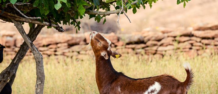
The landscape is a succession of bucolic rural farms, goats, fig trees, and vineyards, with stunning views of the sea, Ibiza, and Es Vedrá. It’s the best place to appreciate Formentera’s traditional architecture, with its small houses with south-facing porches.
We recommend walking along the Camí de Porto Salé, which begins at the old Molino d’en Mateu (beautiful panoramic view), and continuing until you reach Cala Saona. A stop at the restaurant El Sueño,, off the beaten tourist trail, is highly recommended. Its sunny terrace invites you to while away the hours.
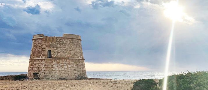
26. Torre de La Gavina
On an island besieged by pirates, towers were an important part of the settlers’ defense system.
The the tower La Gavina rises on an impressive cliff, surrounded by a rugged, rocky environment. Behind it, Ibiza and Es Vedrá provide the perfect backdrop for one of the island’s most striking landscapes, especially when the wind stirs the sea, which crashes into giant waves against the sharp cliff.
To get there, the ideal route is a hike or bike ride from Can Marroig (approximately 1.5 km). You can also get there by car or motorcycle from the Porto Salé route, although the road is quite rocky at the end.
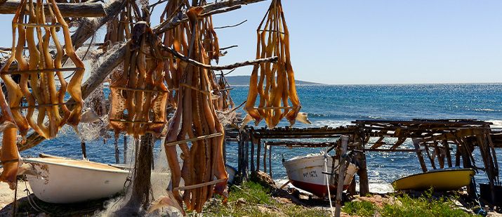
27. Torrent de S’Alga
From the Es Cap junction, the path zigzags between rock walls and traditionally built houses, a charming landscape that delights us at every turn.
At the end, the Torrent de S’Alga is one of the most special and least visited corners of the island. Well sheltered from the winds, it shelters the huts of active fishermen.
You’ll see their boats and fishing gear, as well as the characteristic savina branches stuck in the rock, which are used to dry fish using a traditional technique. Dry fish will later be the star ingredient in the country salad. We recommend you explore this route; you’ll love it.
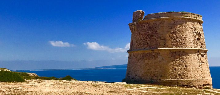
28. Punta Prima
The tower system was intended to monitor the activity of the pirates who were ravaging the islands.
Formentera’s strategic position on the map allowed for control of a large stretch of coastline while maintaining communication with other islands (using fire or smoke).
One of the most panoramic is the Punta Prima Tower, nestled in a cliff landscape, with extensive control of the Levante coast.
(There are three more towers in Formentera: Punta Gavina, Garroverets in Es Cap, and Es Pí des Catalá in Migjorn—it’s the only one that can be visited inside. They date from the 18th century. They are complemented by the older Sa Guardiola tower in Espalmador.)
On your route to Punta Prima, we recommend stopping at the Hotel Sunway bar, with one of the best panoramic views of the island.

